I picked up on scenic U.S. Highway 64 and continued East to Franklin, North Carolina before stopping overnight. Why Franklin? Well, there are two nice campgrounds there where I can stay for less than $10 using my Passport America (see Camping Clubs). As it turns out, stopping here was a miraculous stroke of good luck -- the next morning, I left the RV in the Chartoogechaye Creek Campground (on No Name Road ... lol) and continued eastward on 64 in my truck. East of Franklin, it's such a twisty, mountainous road that I wouldn't recommend anyone attempting it with an RV. Some of the curves are so sharp and narrow, they've mounted those round mirrors that allow you to see around the corner. It's definitely one of the narrowest mountain highways that I've seen and I thought more than once about how lucky I was that I wasn't pulling the RV.
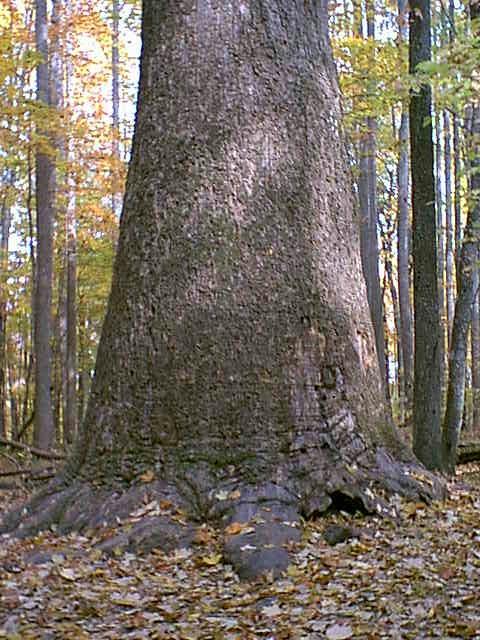
I asked the campground manager where I could go to find the best tree-color, some waterfalls, and do some hiking. He directed me to the world's 2nd largest poplar and some great waterfalls!
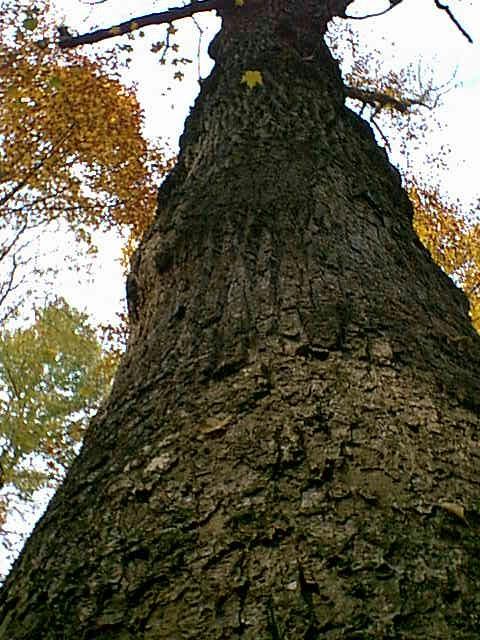
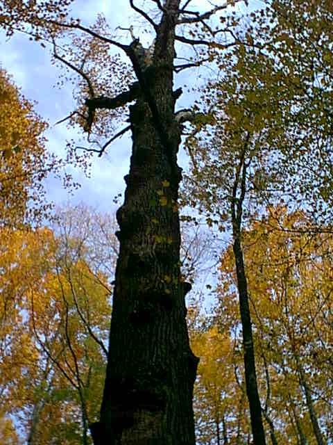
If you go West out of Franklin to the Standing Indian Camping Area of the Nantahala National Forest and stop at the Rocky Gap parking area, it's only a half-mile hike to the Waslink Poplar. It turned out to be a really large tree. I sat and waited awhile when I got to it, hoping somebody would show up to take my picture by it to give an idea of it's size. Nobody showed up, but an amazing thing happened -- as I sat there, I realized I could hear the leaves falling. Suffice it to say it was real quiet and there were alot of leaves coming down. Anyway, I finally decided to just take some pictures and hike on out. Below left is the tree's bottom. Below center is the top. Below right is a picture I took standing at the tree's base and looking straight up. I measured around the base by stretching my arms and it took 5 stretches, so that's about 30 feet.
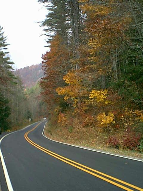
Decided to wrap up with a shot of the highway leading back eastward toward Franklin. There were many really beautiful views where it was just impossible to stop and click, so this is about as good as I could do.
Click on "Back to Index" to peruse these chapters more, or Next Chapter to proceed.

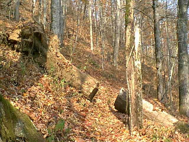
Below are a couple of pictures of the trail leading to the Poplar. Notice in the one on the right that they've taken a unique approach to accommodate a large tree that fell across the trail. Instead of moving it, they merely cut a slot through it wide enough to walk through. On the way down, it was picturesque -- on the way up, it provided a welcome place to sit and catch my breath. Although only a half-mile in, the way back was mostly uphill and the altitude was around 3000' and I'm an old guy, so was puffing pretty well by the time I got back to the parking lot. And I had forgotten my Boquillas walking stick -- so I had to find one in the forest -- not as classy, but it got the job done ... hoho.
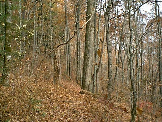
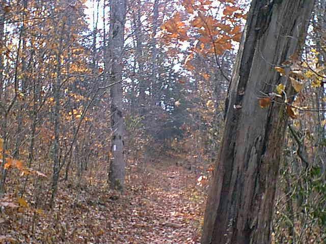
Now this picture to the right might look like an ordinary trail, but it's not. It's part of the famous Appalachian Trail that stretches from Maine to Florida (1600 miles I think). I can now say that I've hiked the Appalachian -- or at least 1/6400th of it.
Then, if you go back eastward through Franklin, 64 East becomes the Highlands Road. As you get closer to Highlands, it becomes the Franklin Road ... lol.
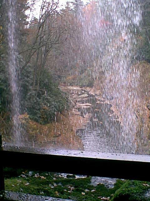
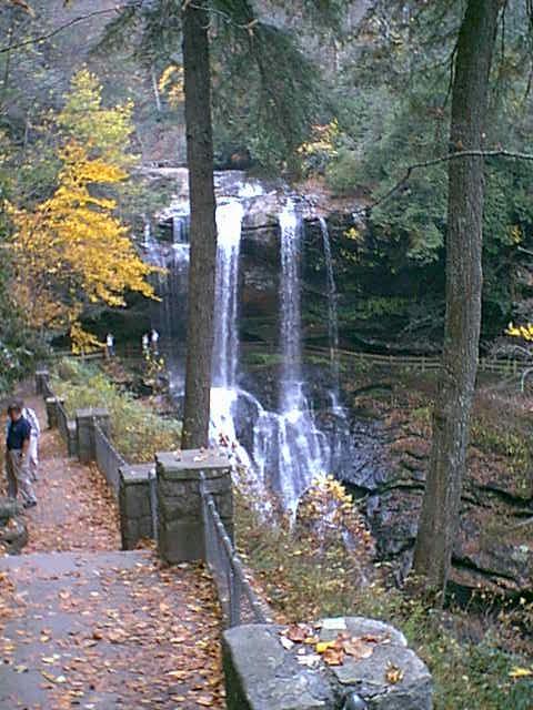
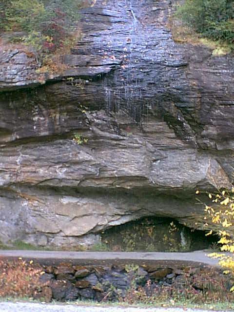
Anyway, below are some great waterfalls on the Highlands Road. Left is Dry Falls from the outside, center is Dry Falls from behind the falls, and right is Bridal Veil Falls. I guess it's claim to fame is that it's real thin like a veil and you can drive behind it.
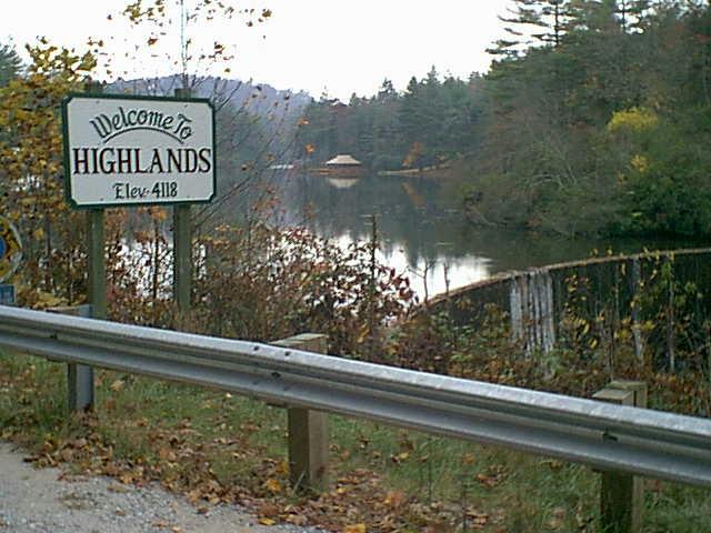
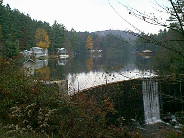
Below is a scene that I thought was quiet beautiful as you come into the town of Highlands, NC. It's just a little lake behind a dam, but the peacefulness of the scene caught my eye on the way in, so I stopped and clicked on the way out.
2004 Update!
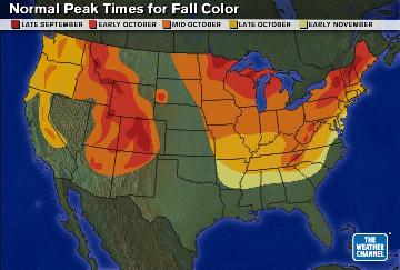
Just found a neat website where they tell the current status of fall colors around the country, normal peak times, etc. Click the color map to go to the Weather Channel website.
32. Poplars And Waterfalls : North Carolina
My Travel Log
Nothing in this site is copyrighted -- I'd be honored if you'd reuse anything you find here for your website

Click any photo for a larger view